
Vibrant Environment
Ocean Talk
All | Biodiversity | Climate Change and Sustainability | Environmental Justice | Governance and Rule of Law | Land Use and Natural Resources | Oceans and Coasts | Pollution Control

The Mississippi River Delta and Louisiana coastline are disappearing. Since the late 1920s, efforts to control the Mississippi through levees and dams have impeded its natural ability to deposit sediment downstream, contributing to large-scale land loss. It’s estimated that Louisiana’s coastal parishes lost roughly two thousand square miles of land between 1932 and 2016. As rising seas driven by climate change threaten to further consume the Gulf coast, there is an imperative to address the growing problem of shrinking landmass. Confronting this threat with a sense of urgency will allow for preservation of Louisiana’s communities, economies, and cultural resources into the future.
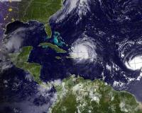
The National Oceanic and Atmospheric Administration (NOAA) reported in August that this year’s Gulf of Mexico dead zone was unexpectedly small—in fact, the third-smallest ever measure in the 34-year record. Interestingly, this comes just two months after NOAA had forecasted a larger-than-average dead zone in early June. The cause of this shift appears to be Hurricane Hanna, whose large, powerful waves agitated the water column, disrupting algal accumulation in the Gulf.

Public meetings are a fundamental component of many policymaking and planning processes, including the natural resource damage assessment (NRDA) process that aims to restore the Gulf of Mexico ecosystem and the permitting and environmental review procedures for individual projects.
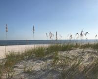
The Gulf Coast region historically is known for producing more seafood than anywhere else in the continental U.S., both in volume and dollar value. However, since Hurricane Katrina in 2005 and the Deepwater Horizon oil spill in April 2010, fishing communities along the coast who depend upon healthy and vibrant marine habitats have experienced significant financial instability.
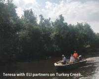
Last month, fellow ELI Gulf Team member Teresa Chan and I travelled to Mississippi to attend two public events hosted by the Deepwater Horizon natural resource damage assessment (NRDA) trustees: a community education workshop in Gulfport, and the Trustee Council’s annual public meeting in Long Beach.

This conversation with Danny Le, BPSOS, is part of the ELI Gulf of Mexico team’s “Why I Participate in Gulf Restoration” blog series. The series aims to highlight the views of community members impacted by the BP oil spill, and provide a glimpse of some challenges and successes they face in getting involved in the restoration processes.

Historically, the Gulf Coast region has produced more seafood than anywhere else in the continental U.S., both in volume and dollar value. Before the BP oil spill, in 2009, the Gulf seafood industry provided over 213,000 full- and part-time jobs. The oil spill has had a devastating impact on people working in the Gulf’s seafood industry. As a result of the BP oil spill, over 88,000 square miles of the Gulf’s federal waters—nearly 37%—were closed to fishing. There were also fishing closures in the state waters of Alabama (40% closed), Florida (2% closed), Louisiana (55% closed), and Mississippi (95% closed). Fishermen are still facing financial instability years after the spill, and have observed significant declines in landings and stock quality. Here, we highlight one Gulf fisherman’s perspective.
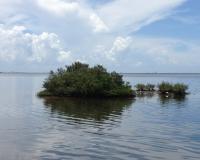
On August 30, the Gulf Coast Ecosystem Restoration Council (the “Council”) announced that it is seeking public comment on a proposal to “approve implementation funding for the Robinson Preserve Wetlands Restoration project” in Florida. If the proposal is approved, the Council will allocate $1,790,546 in RESTORE Act (Pot 2) funds to implement the project, including a “reallocat[ion of] $470,910 from planning [funds] to implementation.” According to the Council, the project will restore approximately 118 acres of habitat, including coastal upland, wetland, and open water habitat types, in the Tampa Bay Watershed.
Charting the Course: A Survey on Public Engagement in the Natural Resource Damage Assessment Process
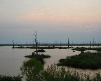
Public participation and engagement are easy values to talk about generally, but are difficult to implement meaningfully. In Gulf restoration, the natural resource damage assessment (NRDA) process provides the federal government, states, and the public with an unprecedented opportunity to pursue the difficult actions that put these values into practice.